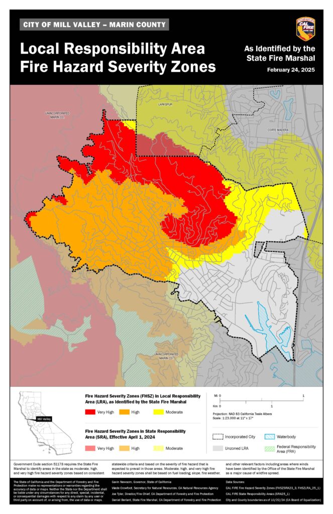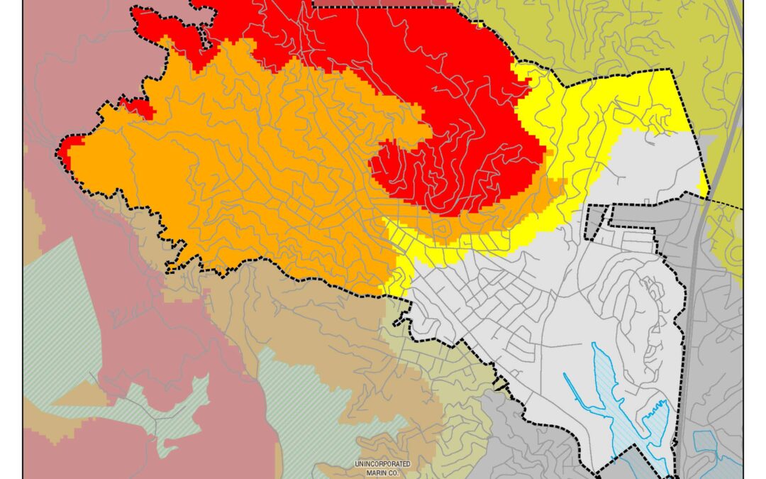
On the heels of former Mayor John McCauley and a number of figures within Mill Valley and beyond concerned about fire danger as city and county officials seeks to build more housing, word came this week about new Bay Area fire-hazard maps, with the obvious question being: Is your city among those seeing striking increases?
Cal Fire’s Fire Hazard Severity maps for local jurisdictions, issued in 2011, are being updated, with Bay Area maps released Monday. While the old maps showed only areas deemed “very high” hazard, the new ones show that category, with “high” and “moderate” below it.
Homeowners who live in areas now deemed at very high hazard on the maps will have to comply with “Zone 0” regulations expected to take effect at the start of next year that include a mandated five-foot zone around every house free of flammable materials vulnerable to flying embers.
California fire officials released long-awaited maps on Monday showing fire risk in cities across the Bay Area and along the northern coast of California.
The maps, which are still in draft form, will have major implications: They will guide where stricter fire-resistant building and landscape rules apply, and are an update to fire risk maps issued more than a decade ago. For example, the state’s pending ban of plants and other combustible materials within five feet of homes will apply to properties categorized on the new maps (i.e., in local responsibility areas) as having “very high fire severity hazard.” That includes parts of Bay Area cities like Berkeley, Oakland, Tiburon, Mill Valley, Santa Rosa, San Bruno, San Jose and Palo Alto.
MORE INFO ABOUT THE MAPS HERE.
MORE INFO FROM THE MARIN IJ: Marin stakeholders, citing LA fires, escalate housing opposition


